The panoramic view looking east across Coed y Brenin from near 'Al's Loop' at the top of the Red Bull route
Although difficult to find the guide to North Wales by Pete Bursnall has a good coverage of the region, published by Earnest Press of Holyhead and well respected publishers of cycling and climbing guides if you find one it will set you back about £7.50 Follow our link here to buy from amazon.co.uk
Books
The featured guides here will help riders unfamiliar with the area to get more out of their rides. Although there has been a shortage of published guides the recent development of trails at Coed y Brenin and Gwydyr have meant not only the Forestry have produced a number but there is also a general greater level of interest both with Tourist Authorities and private publishers. We welcome any unsolicited reviews or copies of material for review and depositing in the club library
Leaflets
original Forestry Red Bull leaflet
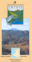
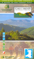
Forest Enterprise Guides are reasonably priced and often updated with fold out maps at 1:25000. The ones here are for Gwydyr Forest and Coed y Brenin and available from Coed y Brenin Visitor Center or the National Park Information Center in Betws y Coed
The latest Guide to the Coed y Brenin MTB Trails with maps including:
Fun Route
Sports Route
Red Bull Trail
MBR Trail
Karrimor Trail.
The leaflet is available at the Visitor Center at £1.50.
contact 01341 440666
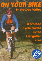
On your Bike. the original title is alas now out of print, a joint effort between Clwyd CC and NWMBA, it was a fold out waterproof map of routes in the Clwydian Hills. Denbighshire CC has produced another guide to 3 MTB routes around Llangollen which are all waymarked with a new guide to the Clwydian Hills to be published Autumn 2002 and will be available from Loggerheads Country Park tel 01352 810614
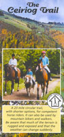
The Ceiriog Trail is a joint initiative between horse riders, Wrexham Council and local tourism businesses. Although aimed at horse riders, the waymarked route follows rights of way open to cyclists in the very scenic Ceriog Valley on the Welsh Border near Oswestry. Cyclists should take care to ensure they take account of the likelihood of equestrians being around when using the route. Details can be obtained from local tourist information offices
Gwynedd Council has produced a number of useful guides although mainly aimed at road cyclists they make a good alternative routes when the trails are waterlogged. Often using the excellent network of traffic free cycle trails running along disused cycle trails
If you are looking for more general guides to Wales and it's history or environment as well as uk cycling of maps check out Amazon UK